Drill-Ready Porphyry Copper-Gold-Silver-Molybdenum Target in the Tintina Gold Province, Eastern Alaska
Key Highlights
14,800 Acres
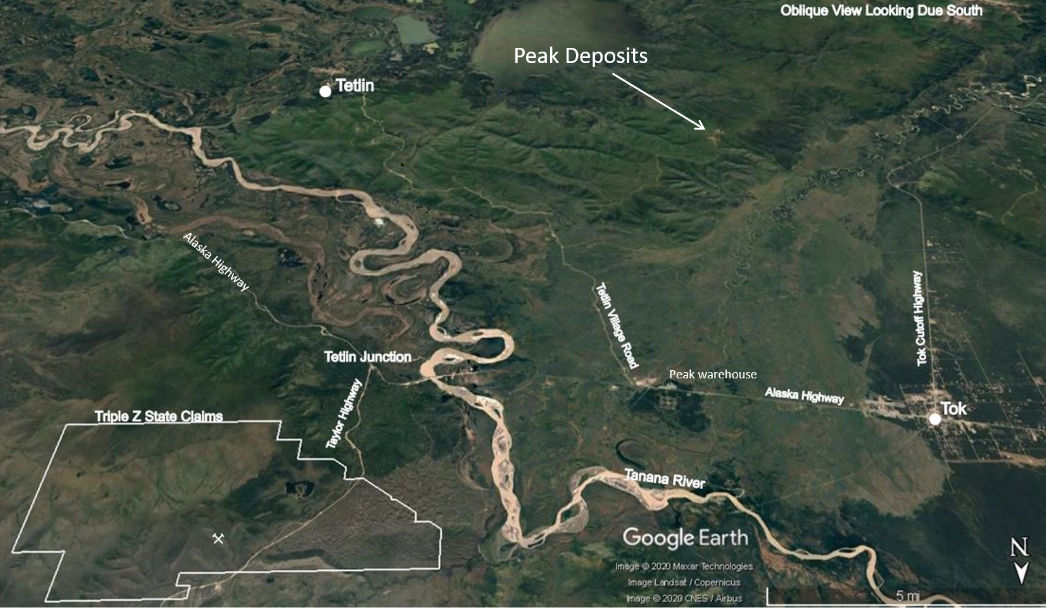
A consolidated claim block immediately adjacent to the Alaska Highway to the south and west and the Taylor Highway to the north and east.
Classic Porphyry Signature
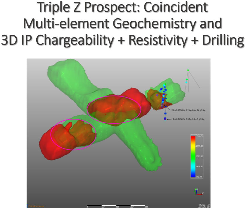
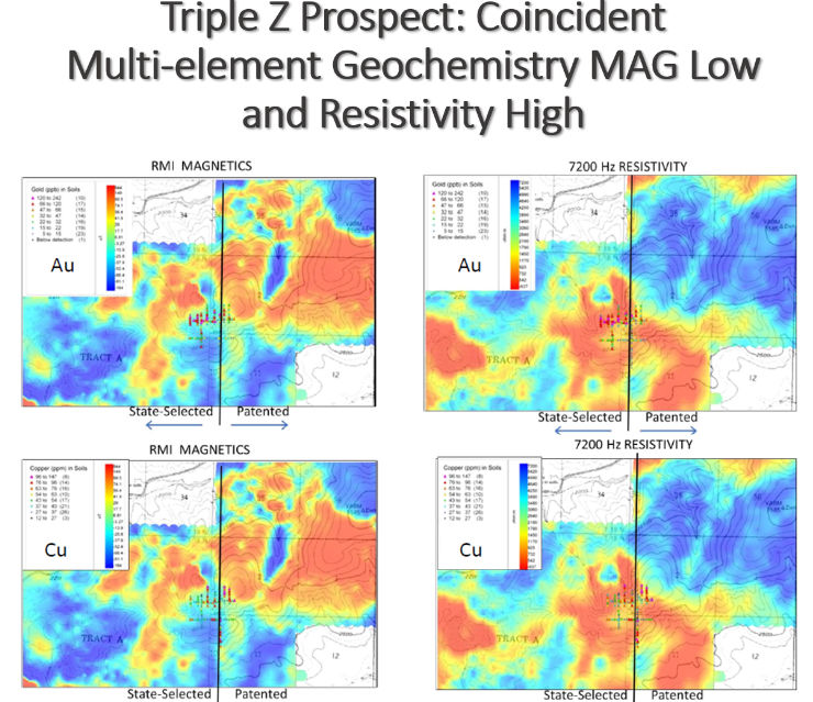
A large copper-gold-silver-molybdenum soil anomaly coincides with a magnetic low, resistivity high, and multiple IP anomalies.
Mineralization Confirmed in Drilling
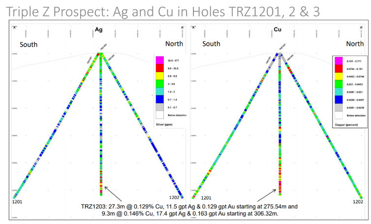
Hole 1203 intersected 27.3 m grading 0.129% Cu, 11.5 g/t Ag, and 0.129 g/t Au, with additional anomalous zones in surrounding holes.
Road Access | Drill-Ready
Highway access on two sides, with the main targets defined and ready to drill.
Overview
Project Overview
Triple Z is a drill-ready porphyry copper-gold-silver-molybdenum target in eastern Alaska. The claims were staked in 2009 and expanded in 2011 and 2019, and now cover 14,800 acres bounded by the Alaska Highway to the south and west and the Taylor Highway to the north and east.
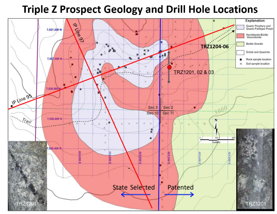
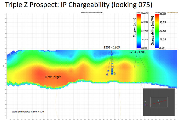
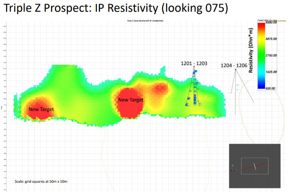
The area was identified as prospective for porphyry mineralization through regional government stream sediment sampling. Surface rock and soil sampling from 2009, followed by auger soil sampling through 2011, defined a large copper-gold-silver-molybdenum anomaly centered on a low-profile ridge. A 2011 airborne survey showed a coincident magnetic low and resistivity high over the anomaly, the classic porphyry signature, and a 2019 Induced Polarization survey outlined multiple IP anomalies broadly coincident with the soil and airborne results.
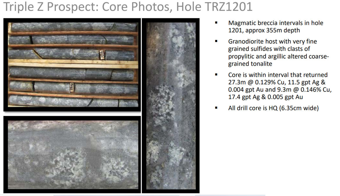
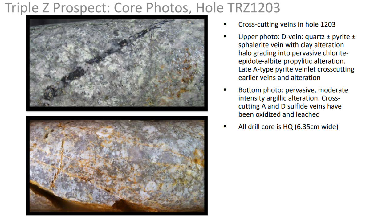
Six core holes drilled in 2012, before the IP survey, confirmed the system. The best results came from hole 1203, which intersected 27.3 meters grading 0.129% Cu, 11.5 g/t Ag, and 0.129 g/t Au from 275.5 meters, and 9.3 meters grading 0.146% Cu, 17.4 g/t Ag, and 0.163 g/t Au from 306.3 meters. Other holes returned narrow anomalous precious metal intervals with lead and zinc, typical of the distal portions of a porphyry system.
Key Project Metrics
LocationEastern Alaska, at the junction of the Alaska Highway and Taylor Highway corridors
Ownership100% Contango Silver & Gold; State of Alaska mining claims
AccessRoad access via the Alaska Highway and Taylor Highway
Strategy
Exploration Rationale & Plan
The main Triple Z targets remain undrilled because the ground sat within a block of land whose transfer between the Bureau of Land Management and the State of Alaska had been in process since Statehood. That land transfer has been completed, and Contango will be drilling in 2026 to test the main target, a well-defined porphyry copper-gold-silver-molybdenum anomaly where soils, magnetics, resistivity, and IP all coincide.
Image Gallery
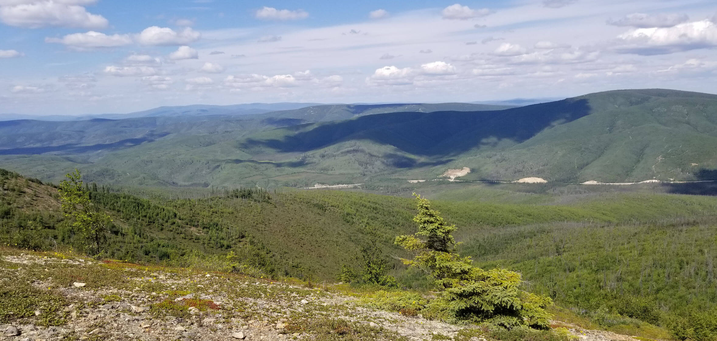
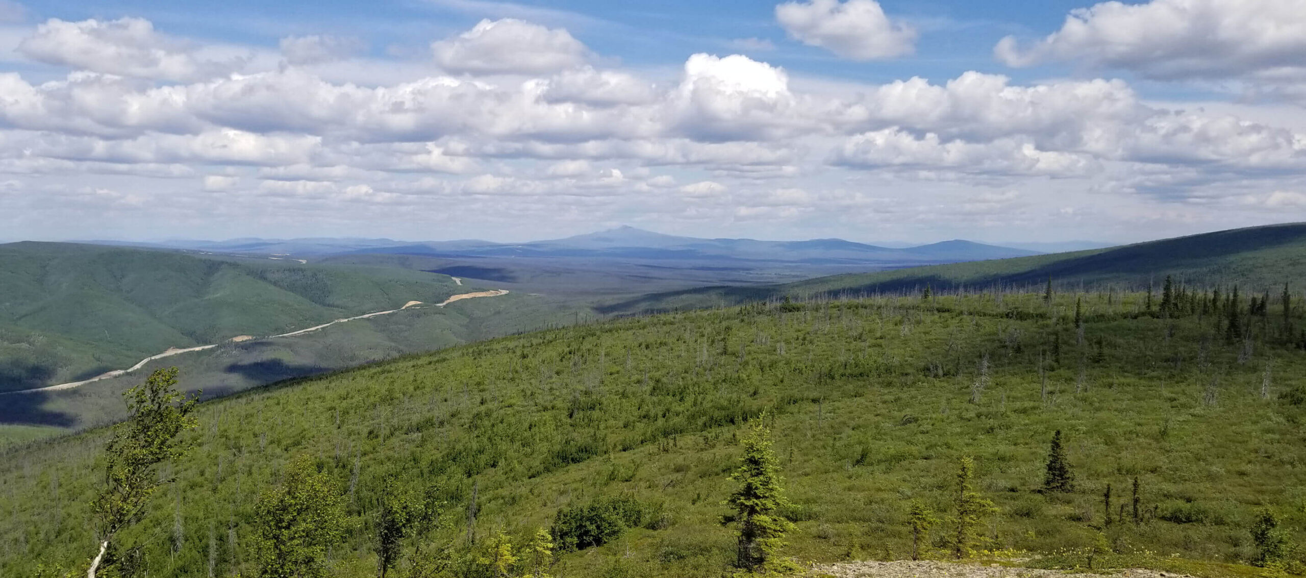
Triple Z Site Photo
Triple Z Site view
Triple Z Prospect: Ag and Cu in Holes TRZ1201, 2 & 3
Triple Z air photo
Triple Z Prospect: Core Photos, Hole TRZ1201
Triple Z Prospect: Core Photos, Hole TRZ1203
Triple Z Prospect Geology and Drill Hole Locations
Triple Z IP and Drilling
Triple Z Prospect: IP Chargeability (looking 075)
Triple Z Prospect: Coincident Multi-element Geochemistry MAG Low and Resistivity High