Large Intrusion-Related Gold System with High-Grade Skarn Mineralization in Eastern Alaska
Key Highlights
4 to 14 g/t Au in Skarn Samples
Rock sampling of mineralized skarn areas identified gold-rich mineralization, with pan concentrates from Hona Creek and 9 Gram Creek running 1 to 9 g/t gold.
Drill-Confirmed Gold System
Kennecott drilling in the late 1990s and follow-up Peak Gold JV holes both intersected gold mineralization, confirming a large, target-rich system.
Modern Geophysics in Hand
A 1,006 line-kilometer airborne magnetics and VTEM survey, combined with State geophysics and ASTER alteration mapping, defines coincident targets.
Within 10 km of Highway
Helicopter accessible today, with the State-maintained, all-weather Tok Cut-off to Glenn Highway within 10 kilometers.
Overview
Project Overview
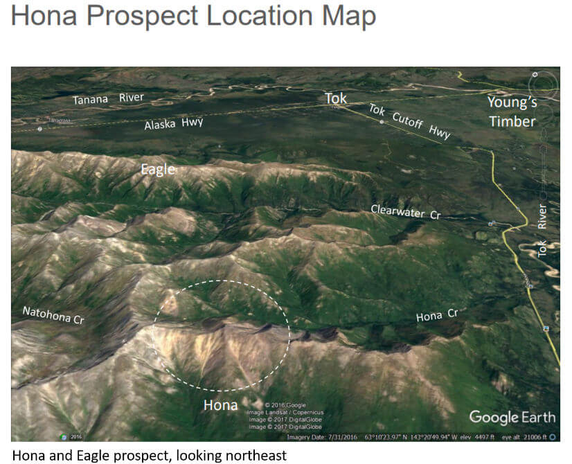
Hona is an intrusion-related gold prospect in Contango Silver & Gold’s eastern Interior Alaska portfolio, located immediately south and west of the Eagle claim block. The block was staked in 2016 and is centered on a series of prospects historically known as Hona, Noah, or Natahona, at elevations ranging from 3,000 to 6,680 feet.
Kennecott Exploration originally identified and drilled the prospect in 1997 and 1998, completing three holes totaling 885 meters. Later re-logging demonstrated the holes intersected narrow, high-grade zones of gold and associated metals. Subsequent regional stream sediment and pan concentrate programs outlined several broad areas of anomalous gold and pathfinder elements, and rock sampling of mineralized skarn returned 4 to 14 g/t gold.
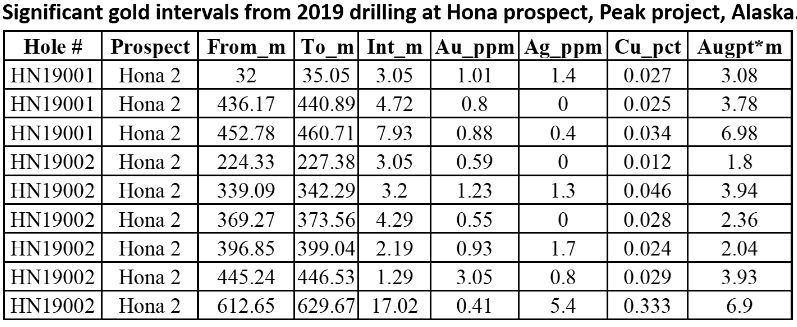
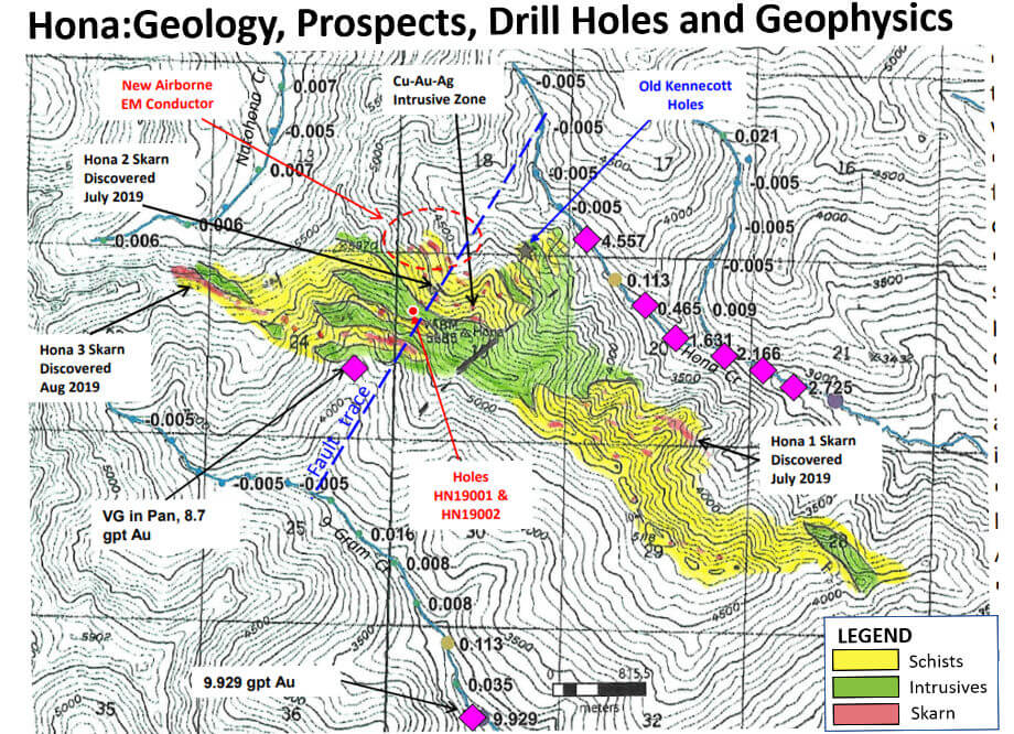
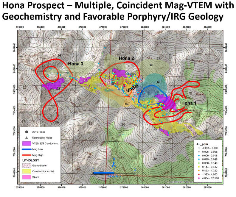
Layered modern datasets have sharpened the targets. ASTER-SWIR remote sensing mapped widespread montmorillonite and kaolinite alteration typical of porphyry and gold systems, State of Alaska airborne surveys added magnetics and resistivity coverage, and a Peak Gold JV airborne magnetics and VTEM survey flew 1,006 line-kilometers over the prospect. Multi-gram gold samples at Hona 2 coincide with a strong magnetic high, a discrete conductivity high, and the most intense alteration patterns. Two follow-up drill holes beneath the Hona 2 outcrops both intersected wide-spaced gold mineralization worthy of further drilling.
Key Project Metrics
LocationEastern Interior Alaska, immediately southwest of the Eagle claim block, centered on VABM Hona
Ownership100% Contango Silver & Gold; State of Alaska mining claims
StatusExploration (drill tested)
Property SizePart of the combined Eagle-Hona claim block: 450 State of Alaska mining claims covering approximately 69,780 acres (28,240 hectares)
Target TypeIntrusion-related gold and gold skarn
AccessHelicopter; within 10 km of the State-maintained Tok Cut-off to Glenn Highway
Unlocking mineral potential
Exploration Rationale & Plan
The Johnson Tract lease is held with Cook Inlet Region, Inc. (CIRI). CIRI selected the Johnson Tract lands through the Alaska Native Claims Settlement Act and, in addition to mineral and surface rights, was granted port and transportation easements across adjoining parkland specifically to support mineral extraction.
The lease has an Initial Term of 10 years, followed by a 5-year Development Term to reach a mine construction decision, and then a Production Term that continues for as long as operations and commercial production are maintained. Minimum exploration expenditures and annual lease payments maintain the lease until production. CIRI retains certain NSR royalty rights and a back-in right for up to a 25% participating interest.
Image Gallery
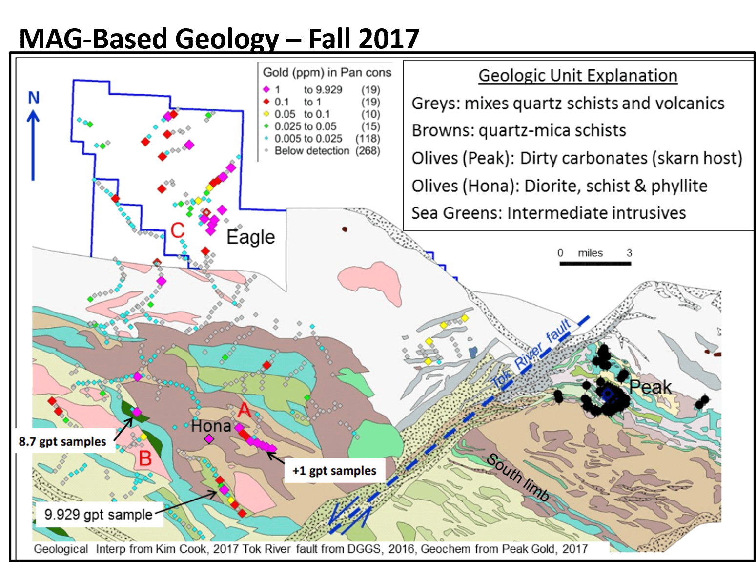
Hona – Mag based Geology
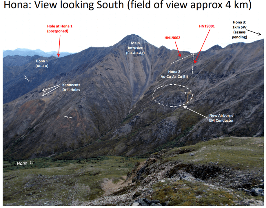
Hona – view looking south
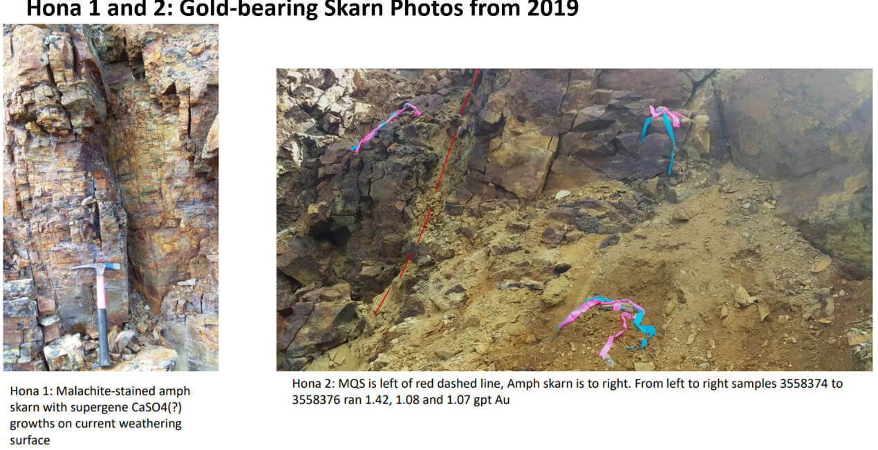
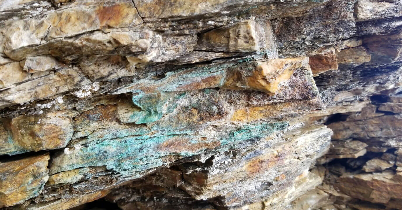
Hona 1-2 Gold Skarn
Hona Project
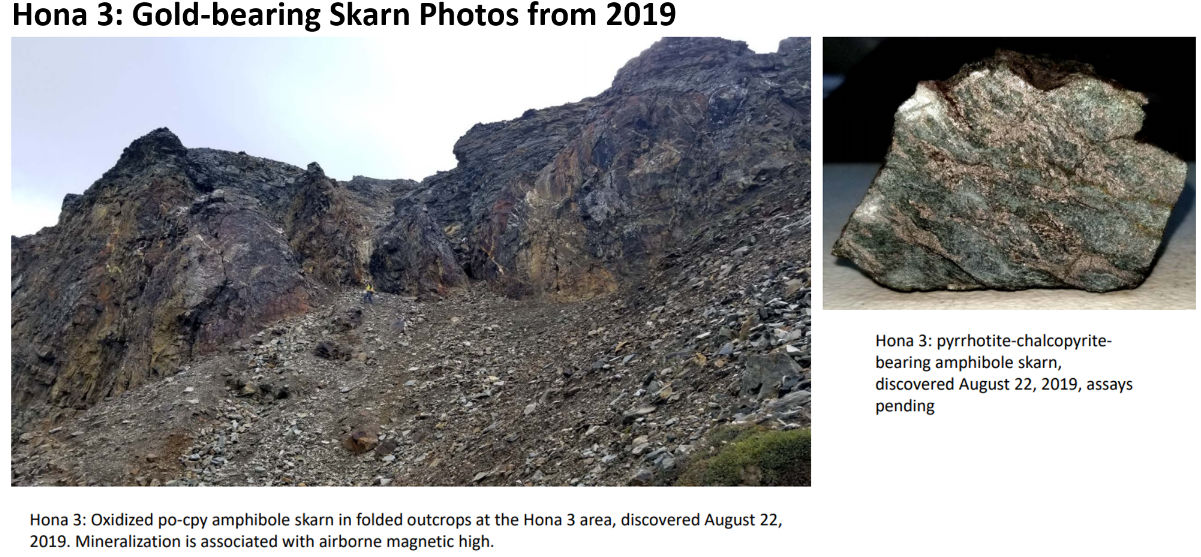
Hona – Gold Skarn
Hona sulfate growth
Hona
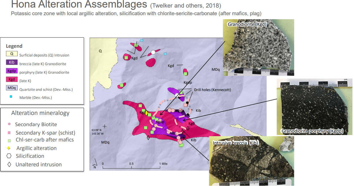
Hona Alteration Assemblages
Hona Prospect Hole HN19002: 611 to 614m
Hona drill intercepts
Hona Prospect: Holes HN19001 & 002 – Geology, Au & Cu
Hona: Geology, Prospects, Drill Holes and Geophysics