CTGO:CA:

CTGO:

SILVER:

GOLD:

Amanita

Amanita


Intrusion-Related Gold Targets Next Door to Fort Knox in the Fairbanks Mining District

Key Highlights

Drill-Ready Targets Near Fort Knox

Targets sit within approximately 5 kilometers of Kinross’ Fort Knox mine and mill in a district that has produced more than 16 million ounces of gold.

~10 km from Fairbanks

Excellent infrastructure with road access to the property and a vast ATV trail network across it.

US$5.1M+ Exploration to Date

Nearly three decades of work including 1,945 meters of core drilling, 4,678 meters of RC drilling, trenching, and drone magnetics.

100% Contango

Comprised of a 1,320-acre Uplands Mining Lease and 55 State of Alaska mining claims covering 2,287 acres.

Overview

Project Overview

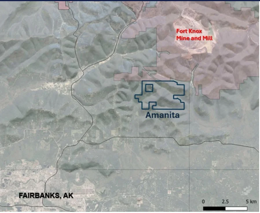
Amanita is a 100% Contango-held gold exploration project in the Fairbanks Mining District, located approximately 10 kilometers from downtown Fairbanks. The project comprises a 1,320-acre Uplands Mining Lease and 55 State of Alaska mining claims covering 2,287 acres, with drill-ready targets sitting within about 5 kilometers of Kinross’ Fort Knox mine and mill.

The Fairbanks Mining District, discovered in 1902, has produced more than 16 million ounces of gold, and Amanita targets the district’s signature intrusion-related gold systems. More than US$5.1 million in exploration has been spent on the property to date.

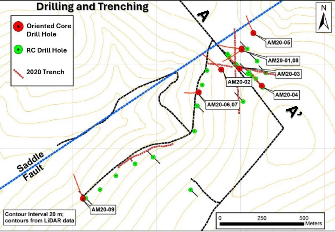
Work from 1996 through 2024 includes 1,414 core samples, 637 rock samples, 933 soil samples, 1,950 meters of trenching, 9 core holes for 1,945 meters, 39 RC holes for 4,678 meters, and 16.5 square kilometers of drone magnetic coverage. Advanced studies include reprocessing of State airborne and electromagnetic surveys, petrographic analysis of host rocks and mineralization from core drilling, oriented core drilling with structural interpretation, LiDAR and drone-based magnetic surveys, and TerraSpec short wave infrared alteration analysis on 1,500 samples.

Key Project Metrics

Location Fairbanks Mining District, Alaska; approximately 10 km from downtown Fairbanks
Ownership 100% Contango Silver & Gold; one Uplands Mining Lease (1,320 acres) plus 55 State of Alaska claims (2,287 acres)
Status Exploration (drill-ready targets)
Property Size Approximately 3,607 acres (1,460 hectares) combined
Target Type Intrusion-related gold system
Access Road access with an extensive ATV trail network across the property

Unlocking mineral potential

Exploration Rationale & Plan

Amanita’s rationale is straightforward: intrusion-related gold targets in a 16-million-ounce district, a five-kilometer drive from an operating mine and mill, with a modern, layered dataset already in hand. The combination of drilling, geochemistry, drone magnetics, LiDAR, oriented core structural data, and SWIR alteration mapping gives Contango well-constrained drill targets. The path forward is drill testing the highest-priority targets defined by that compilation.
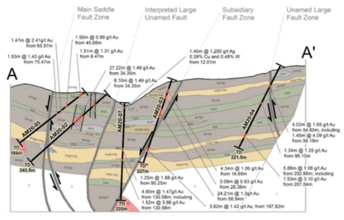
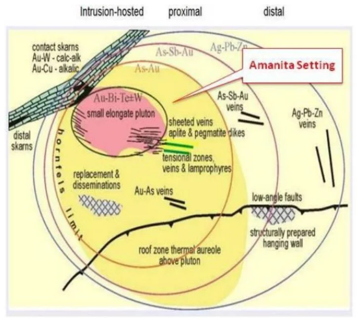
Image Gallery

Amanita property map
Amanita Map
Diagram of the intrusion-hosted gold deposit model for the Amanita setting
Amanita Setting
Amanita map of oriented core and RC drill holes and 2020 trenches
Drilling and Trenching
Map locating the Amanita property near Fairbanks, Alaska
Fairbanks, AK Map
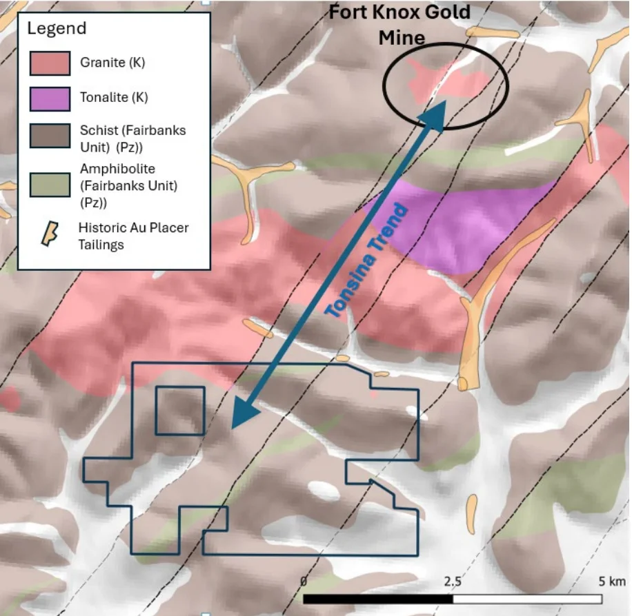
Geology map locating the Amanita property relative to the Fort Knox gold mine
Fort Knox Gold Mine
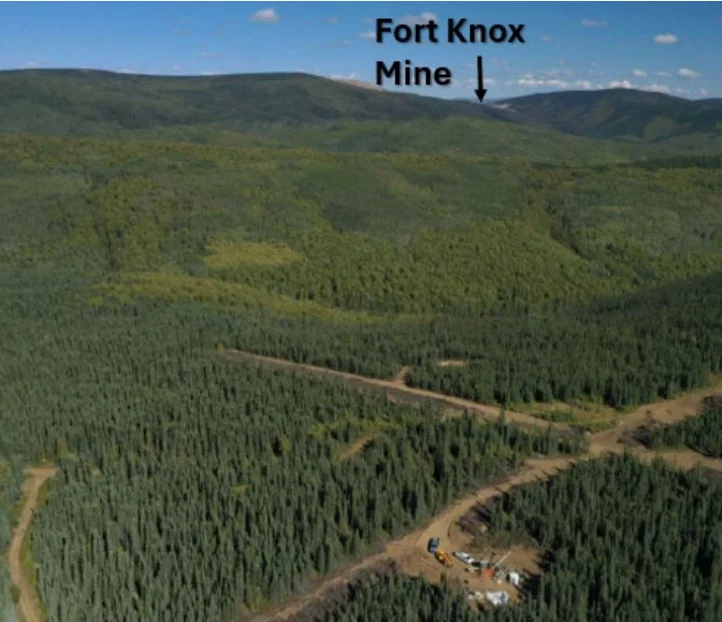
Aerial view of forested hills with the Fort Knox mine in the distance
Fort Knox Mine
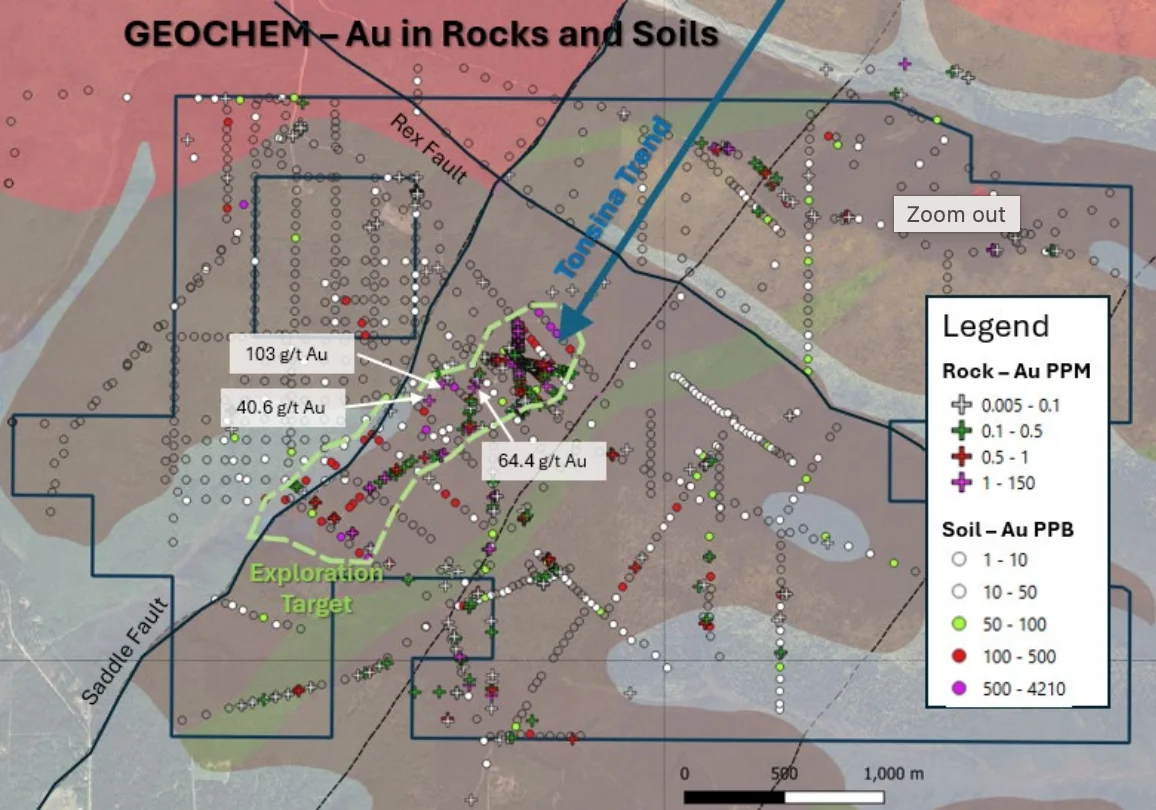
Amanita geochemistry map
Geochem Map
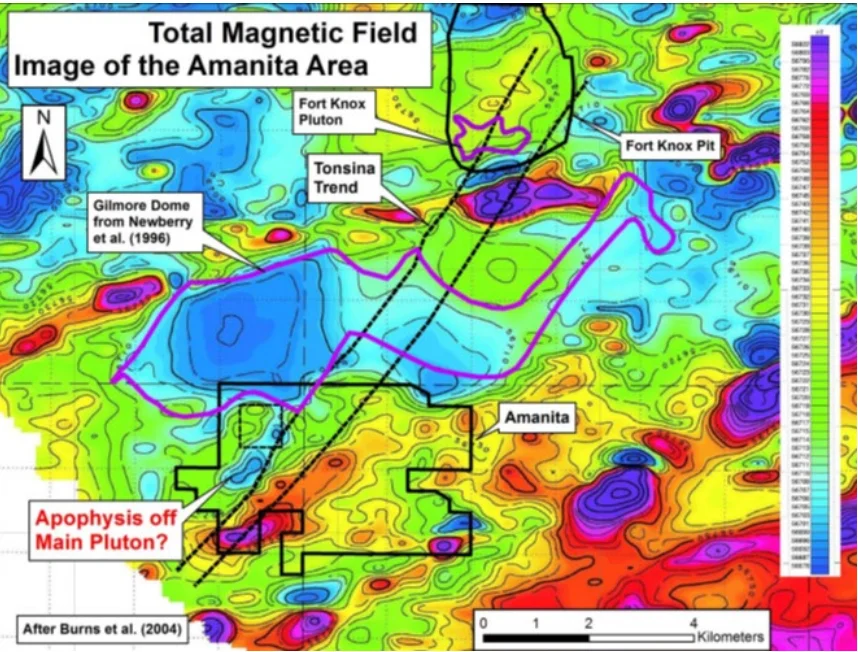
Amanita magnetic field map
Magnetic Field Map
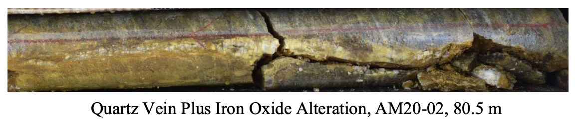
Drill core with a quartz vein and iron oxide alteration, hole AM20-02 at 80.5 m
Quartz vein
Significant gold intercepts from core drilling at Amanita
Significant core drilling Au intercepts