Resource-Stage Intrusion-Related Gold System in Alaska’s Valdez Creek Mining District
Key Highlights
267,400 oz Au Indicated
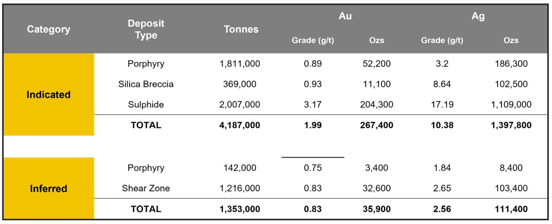
An NI 43-101 compliant, open-pit-constrained resource of 4.2 Mt grading 1.99 g/t Au and 10.38 g/t Ag, plus 1.35 Mt Inferred at 0.83 g/t Au.
25+ Named Prospects
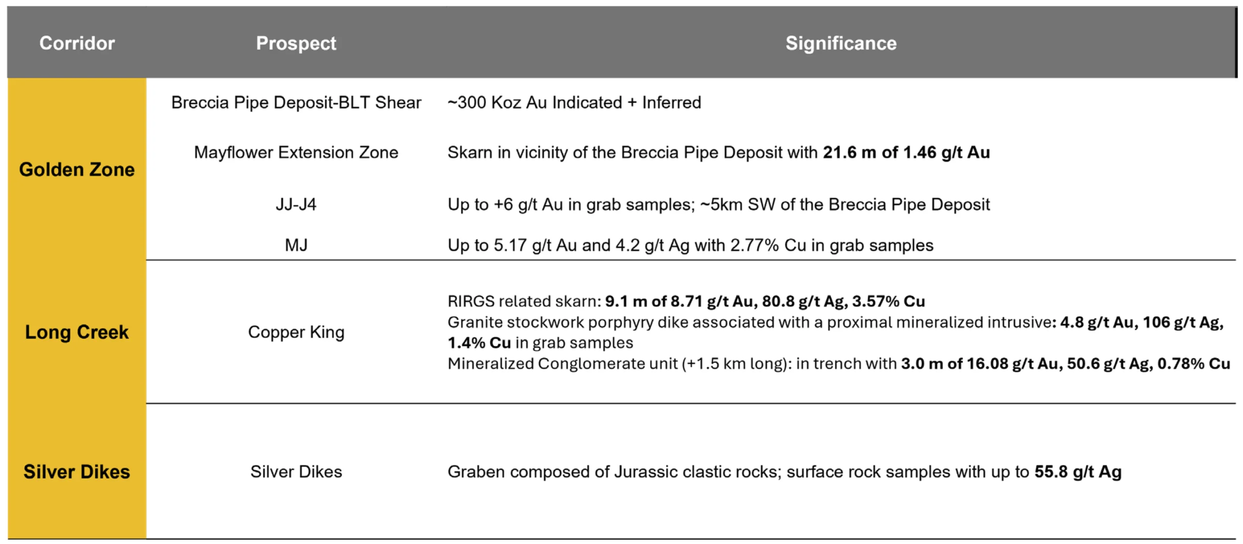
Prospects across three northeast-trending corridors, anchored by the Golden Zone Corridor’s more than 19 kilometers of mineralized trend.
~26,662 m of Drilling
A substantial historic drill database delineates the resource and defines multiple expansion and discovery targets.
100% Contango
A 2,960-acre Uplands Mining Lease running to 2050, surrounded by 68 State of Alaska claims totaling 7,720 acres.
Overview
Project Overview
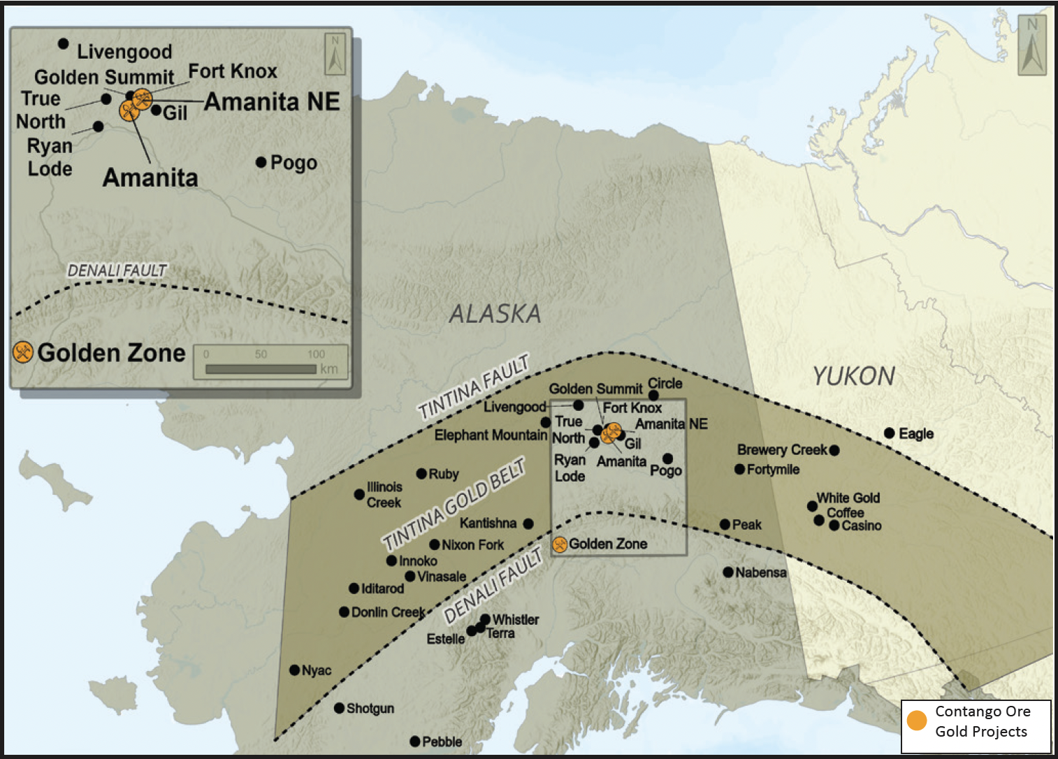
Golden Zone is a resource-stage, reduced intrusion-related gold project in the Valdez Creek mining district of Alaska, 100% held by Contango Silver & Gold. The project comprises a 2,960-acre Uplands Mining Lease with a 2050 expiry, surrounded by 68 State of Alaska mining claims totaling 7,720 acres.
The project hosts an NI 43-101 compliant, open-pit-constrained mineral resource estimate with a total Indicated resource of 4.2 Mt grading 1.99 g/t gold and 10.38 g/t silver at a 0.5 g/t gold cut-off, containing 267,400 ounces of gold, plus an Inferred resource of 1.35 Mt grading 0.83 g/t gold and 2.56 g/t silver. The 2016 estimate, prepared by A.C.A. Howe International Limited, is supported by approximately 26,662 meters of historic drilling. The project was previously owned by Avidian Gold.
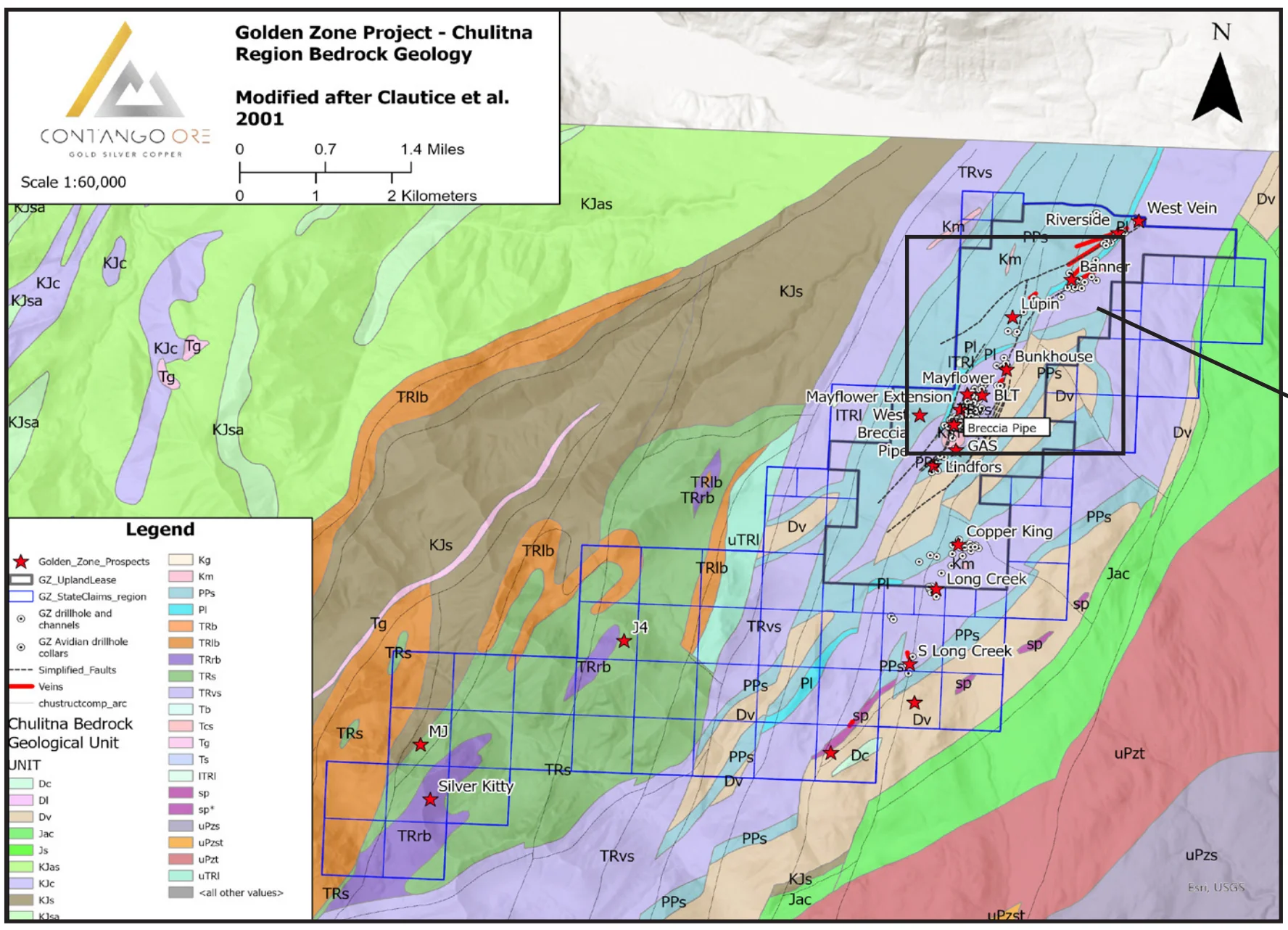
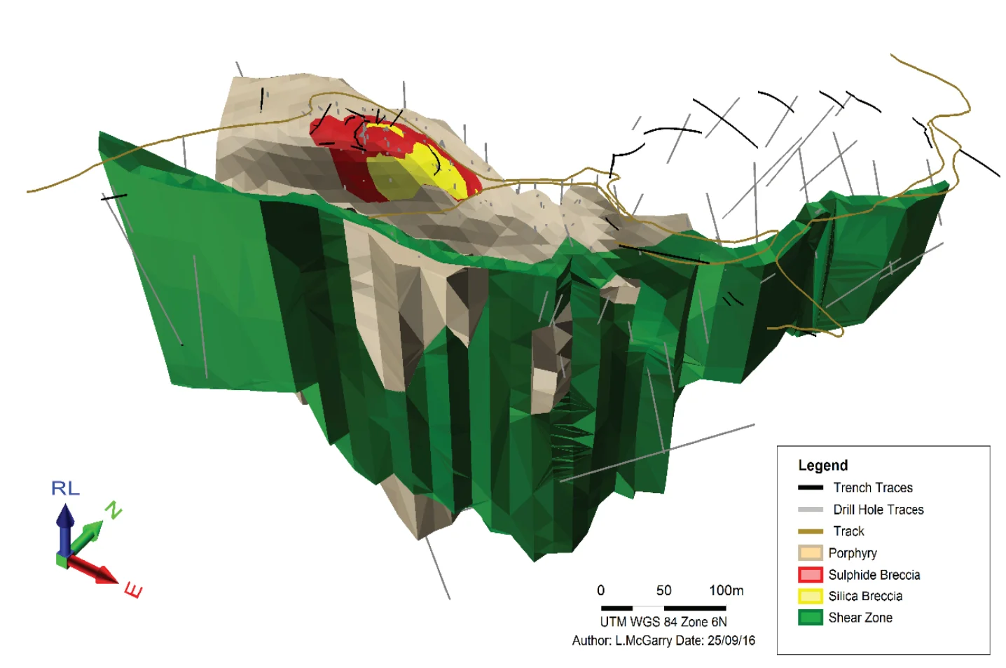
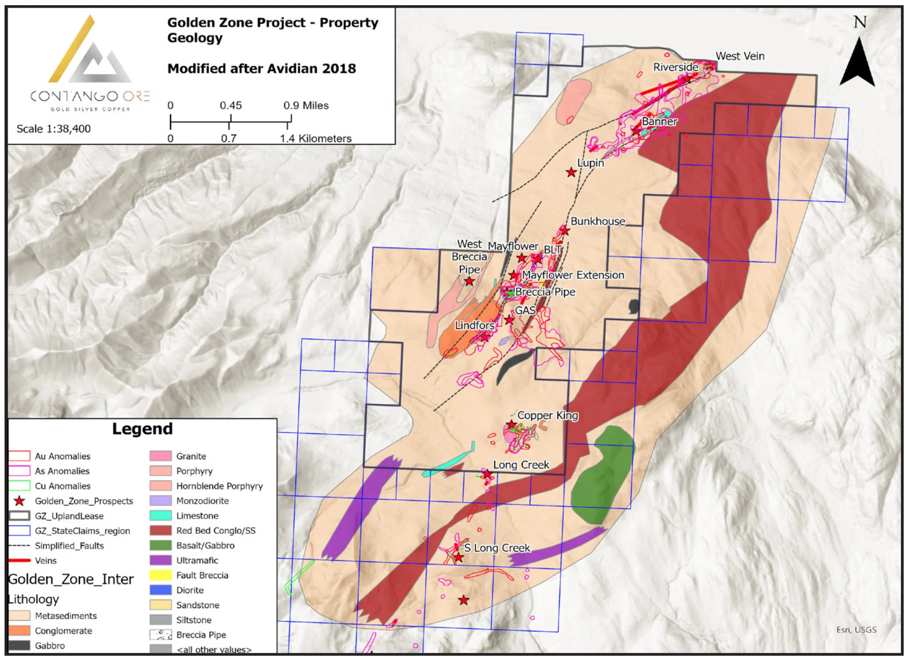
Geologically, Golden Zone sits in the Chulitna Block at the northwestern end of the Wrangellia Terrane, where Paleozoic to Cretaceous metasediments and volcanic rocks are intruded by Late Cretaceous to Early Tertiary stocks and dikes. The resource is anchored by the Breccia Pipe Deposit, a northeast-plunging pipe of crackle to jigsaw breccia hosted entirely within a monzodiorite porphyry stock and healed by quartz and sulfides, together with the BLT-Lindfors Shear Zone, a northeast-striking, steeply dipping, altered and sheared listwanitic vein-dike complex. More than 25 named prospects occur across three corridors: the Golden Zone Corridor (over 19 km of mineralized trend), the Long Creek Corridor (over 3 km), and the Silver Dikes Corridor.
Key Project Metrics
LocationValdez Creek mining district, south central Alaska
Ownership100% Contango Silver & Gold; Uplands Mining Lease (2,960 acres, expiring 2050) plus 68 State of Alaska claims (7,720 acres)
Target TypeReduced intrusion-related gold system; breccia pipe and shear zone hosted
Mineral ResourceIndicated: 4.2 Mt at 1.99 g/t Au and 10.38 g/t Ag (267,400 oz Au); Inferred: 1.35 Mt at 0.83 g/t Au and 2.56 g/t Ag (2016, A.C.A. Howe International)
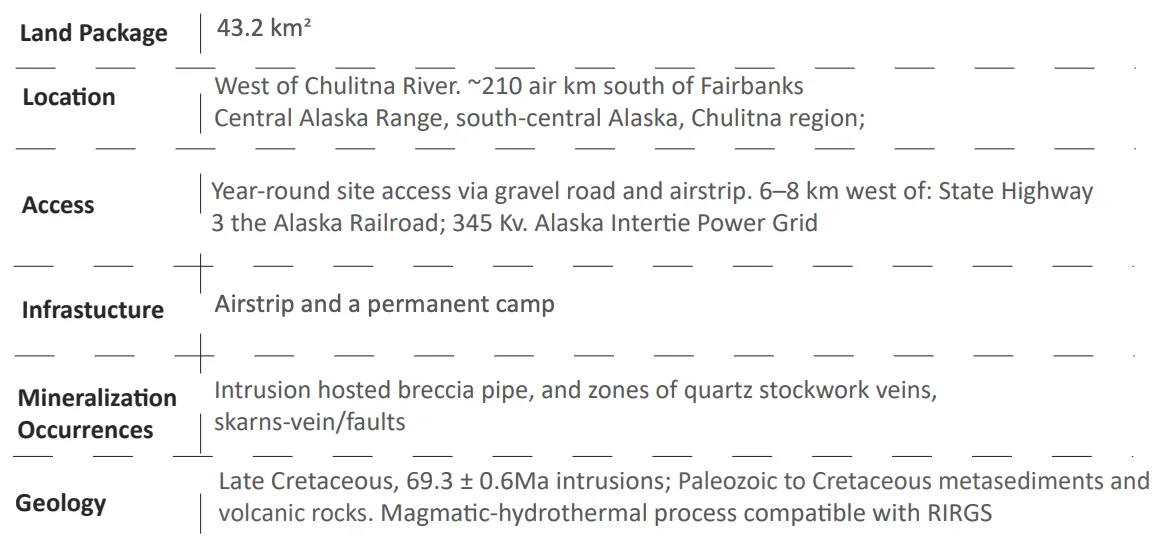
Access/InfrastructureYear-round site access via gravel road and airstrip; 6 to 8 km west of State Highway 3 and the Alaska Railroad; 345 kV Alaska Intertie Power Grid; permanent camp and airstrip
Unlocking mineral potential
Exploration Rationale & Plan
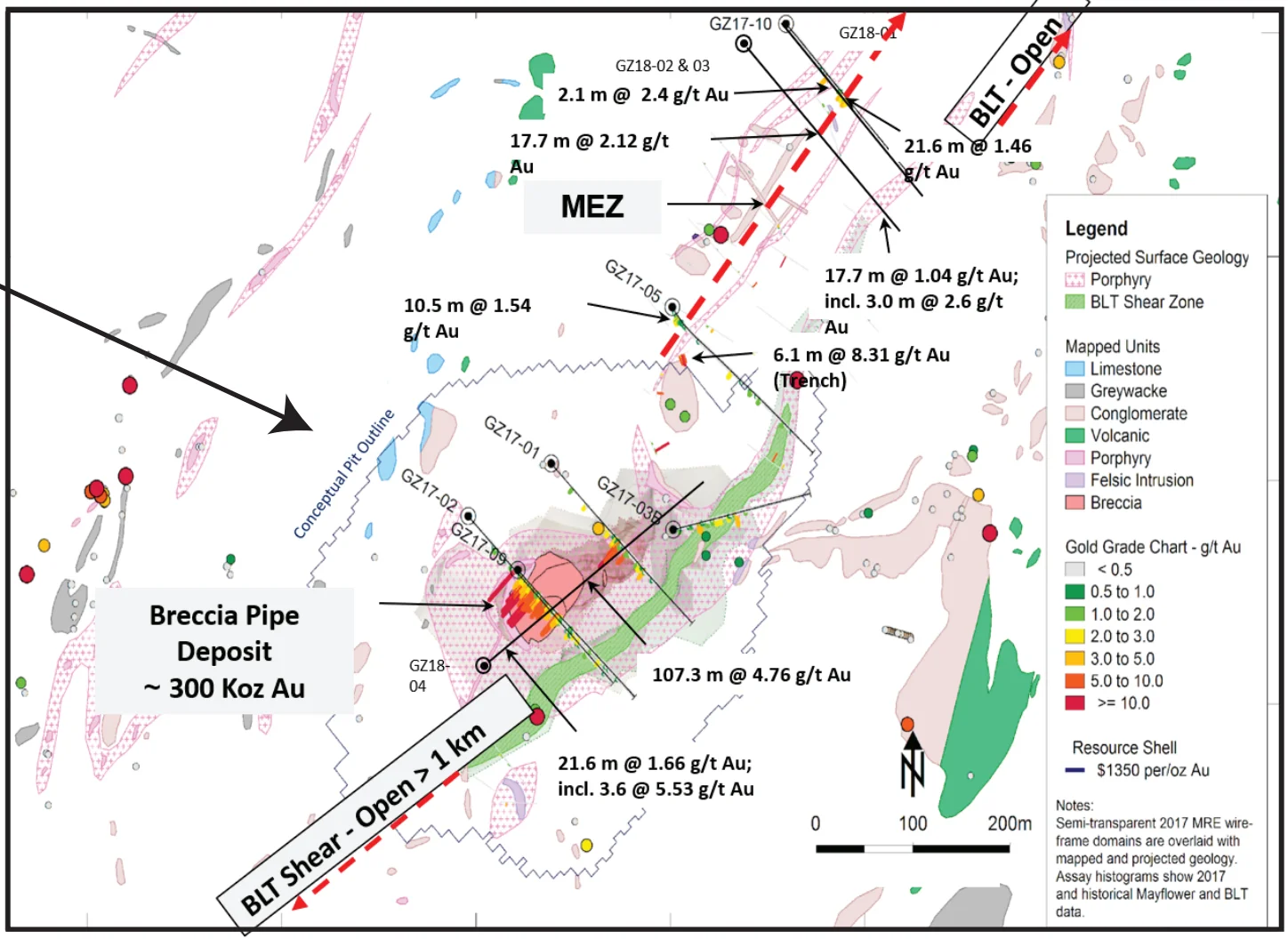
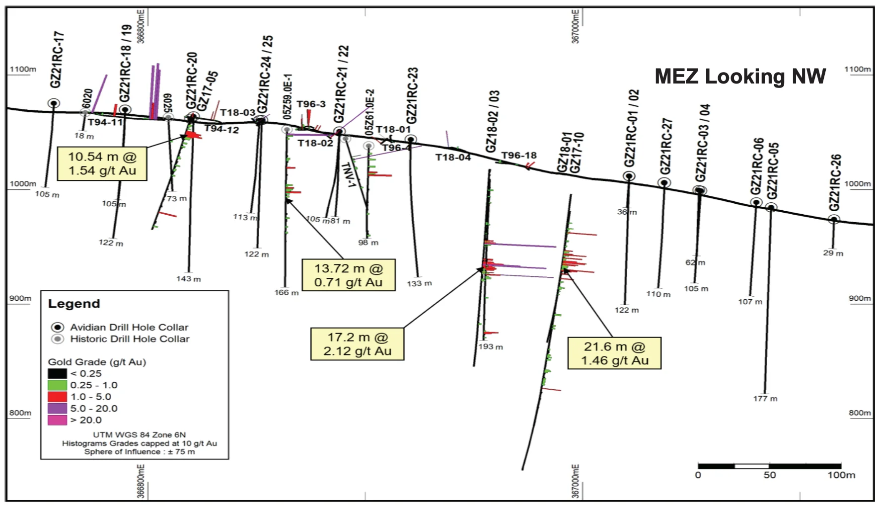
Golden Zone offers a rare combination at the exploration tier: an existing gold resource with clearly mapped room to grow. Resource expansion targets include the Mayflower Extension Zone, an approximately 600-meter trend open to the northeast, more than 1.5 kilometers of mineralization along the BLT Shear Zone, the Breccia Pipe margins below 150 meters, and the mineralized monzodiorite hosting the Breccia Pipe itself. Several breccia pipe intercepts sit outside the 2016 resource and are targets for future expansion drilling.
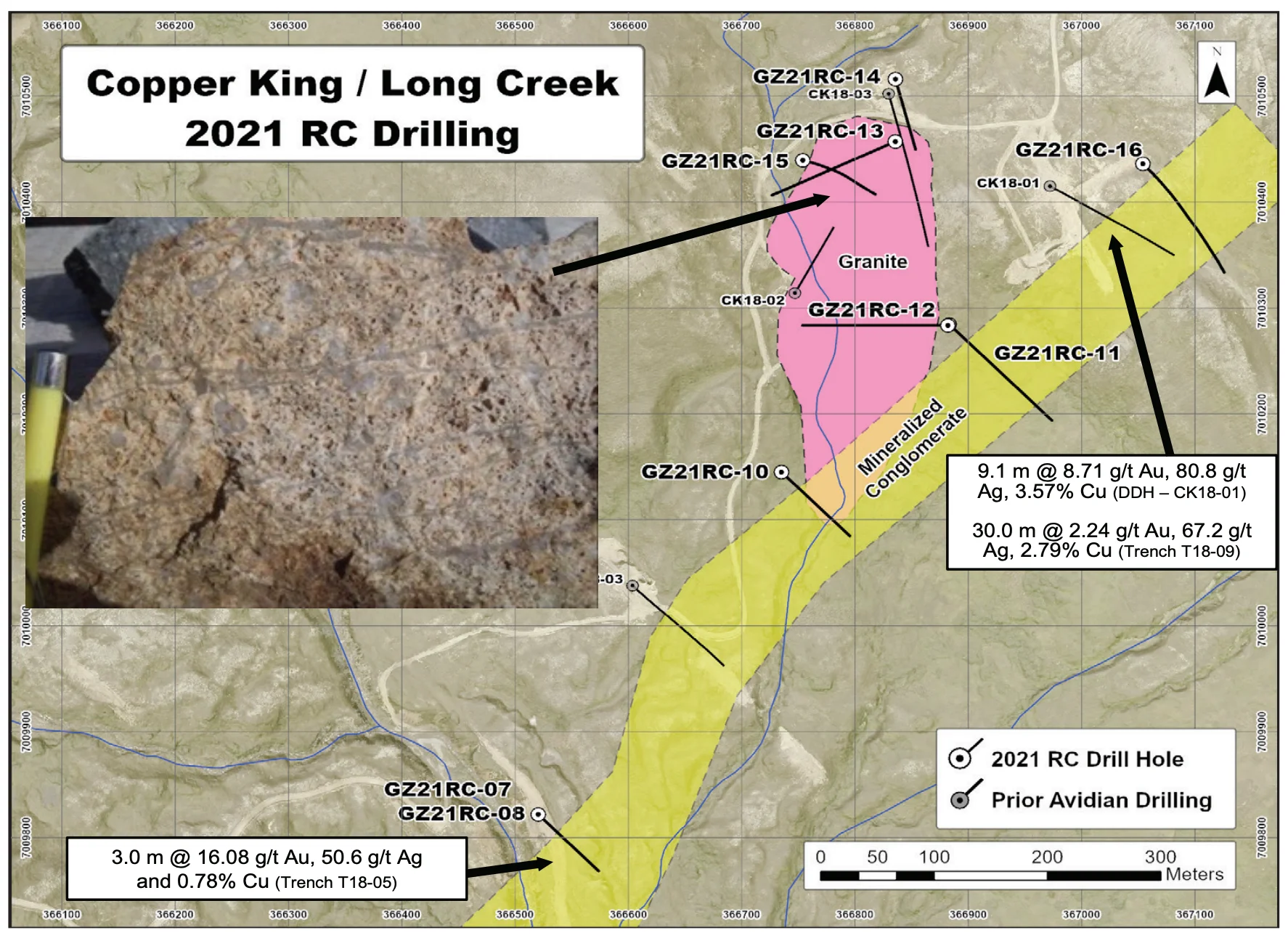
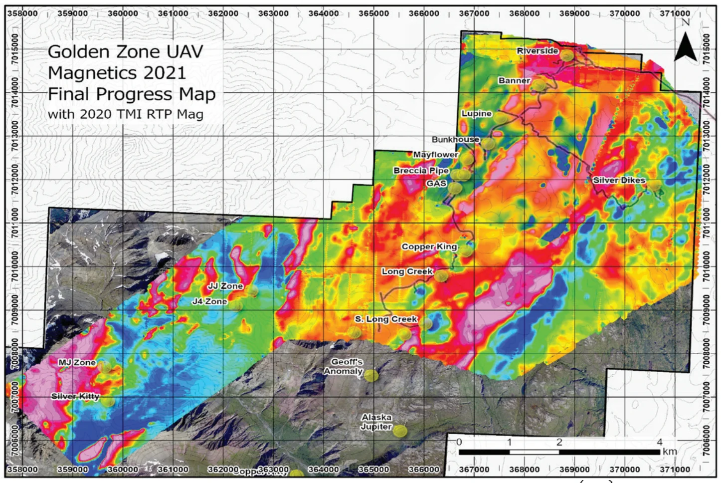
Beyond the resource, drill-ready discovery targets include Copper King, with more than 2 kilometers of mineralized porphyritic stockworks and replacement pyrrhotite-bornite-chalcopyrite mineralization, the Mayflower skarn and vein/fault mineralization, and compelling regional targets such as JJ and MJ, where magnetic highs coincide with grab samples of up to 5.17 g/t Au and 4.2 g/t Au with 2.77% Cu.